

Gunung Sebesi
Provinsi : Lampung - Sebesi Island
Jalur Pendakian Resmi
Memuat Peta Jalur Pendakian
Ketinggian (mdpl)
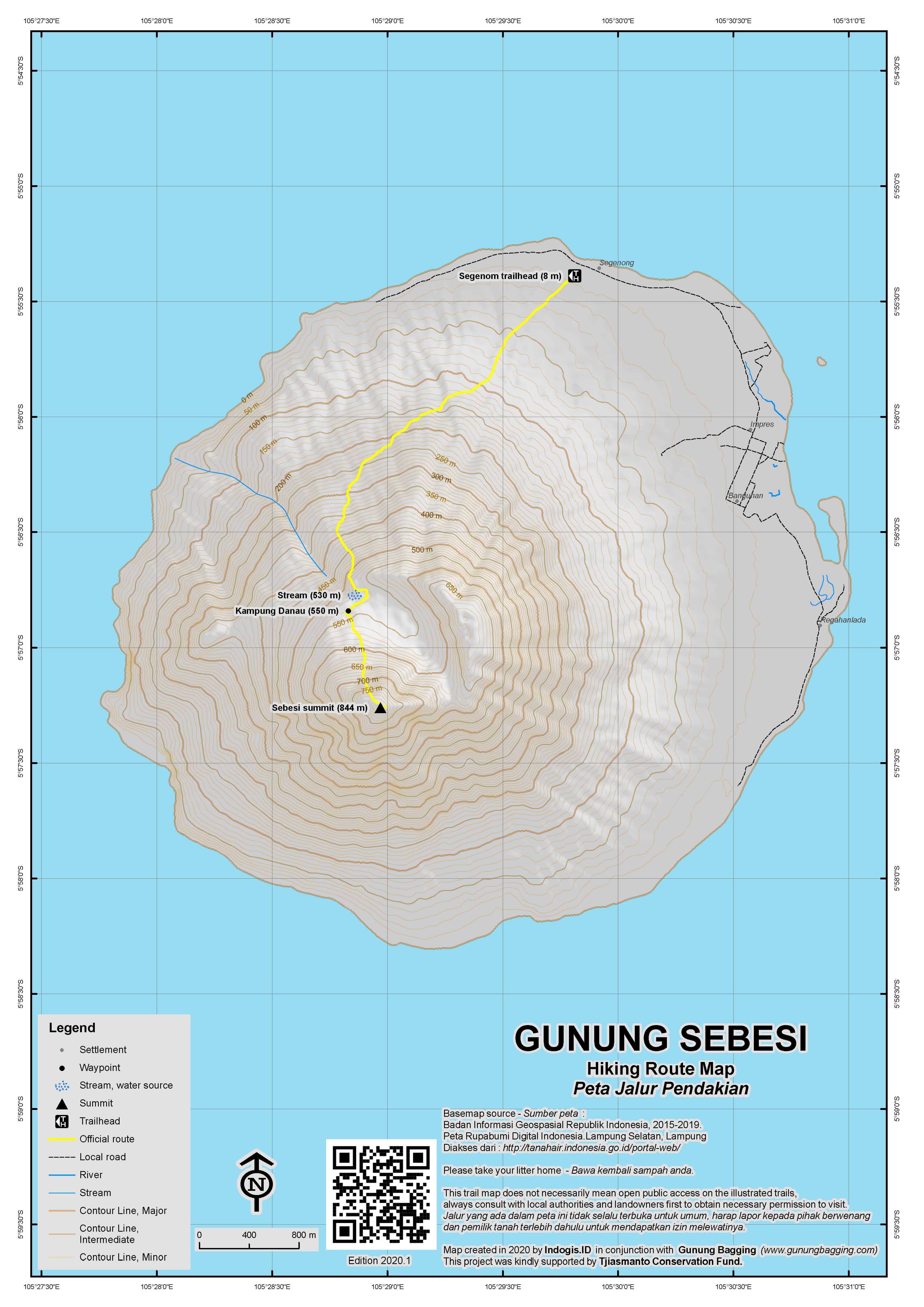
844 m
Prominence
844 m
Koordinat
-5.9543, 105.4828
Lokasi Peta (OSM)
Memuat Peta...
Informasi Pendakian
Guides and GPS Tracks: Want a PDF version for your phone? Looking for a guide? Need GPS tracks and waypoints? Gunung Sebesi information pack can be downloaded here.
Trip planning assistance: Would you like Gunung Bagging to personally help you in arranging your whole trip? Please contact us here.
Permits: Not required but take a photocopy of your passport photo page just incase.
Water sources: Take sufficient supplies with you. There is a stream at 530m and if really thirsty due to the heat you could as a last resort ask for some drinking water at Kampung Danau.
Pembaruan Terakhir: 19 Januari 2027