

Gunung Maras – Bukit Buik
Provinsi : Bangka Belitung - Bangka Island
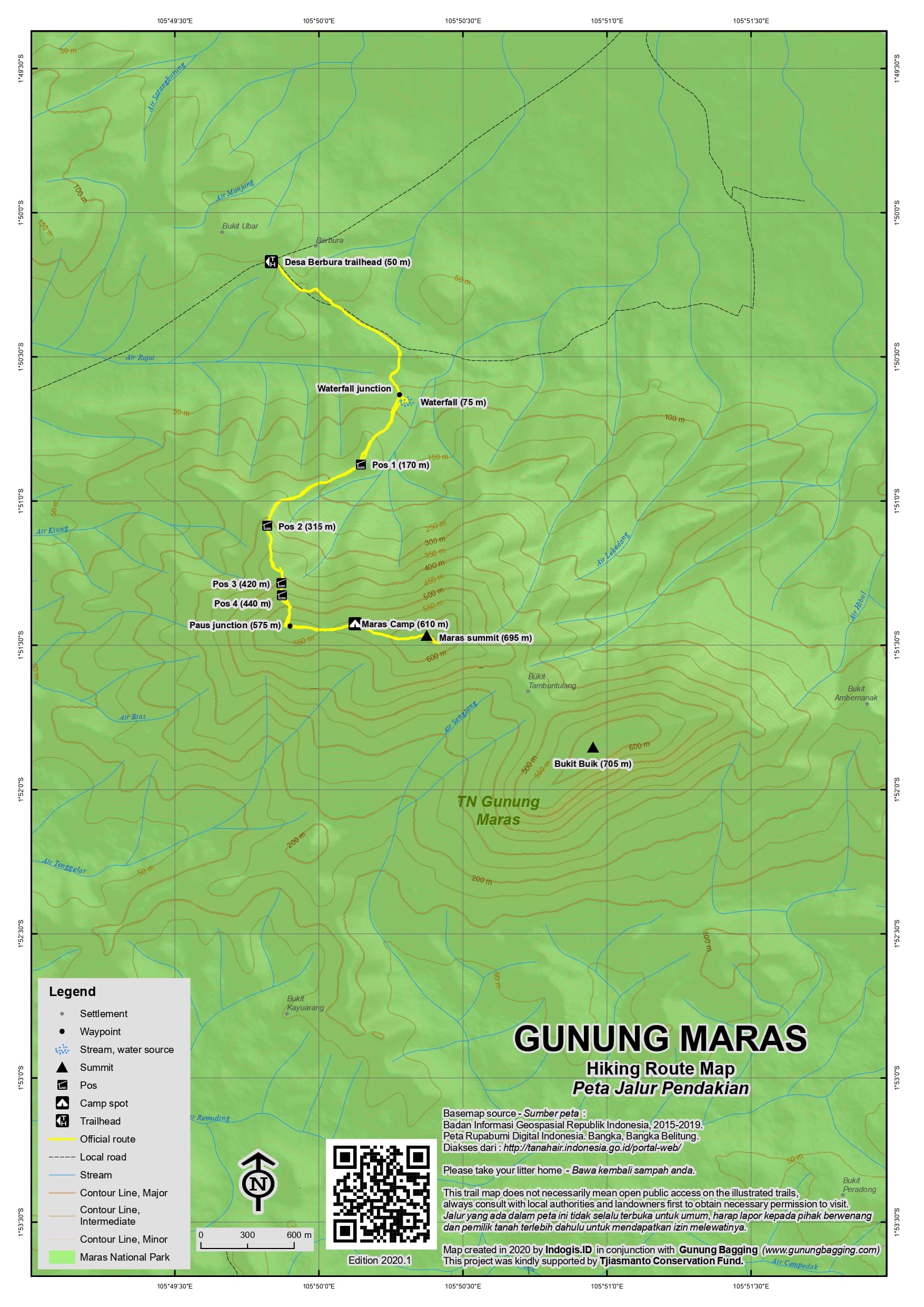
Jalur Pendakian Resmi
Memuat Peta Jalur Pendakian
Ketinggian (mdpl)
705 m
Prominence
705 m
Koordinat
-1.8642, 105.8492
Nama Lain
Buik sometimes spelt with a ‘h’ = Buih
Lokasi Peta (OSM)
Memuat Peta...
Informasi Pendakian
Guides and GPS Tracks: Want a PDF version for your phone? Looking for a guide? Need GPS tracks and waypoints? Gunung Maras information pack can be downloaded here.
Permits: Register at Berbura or Dalil.
Water sources: The waterfall areas at the foot of the mountain on both the Berbura and Dalil sides (100m above sea level only).
We recommend Safety Wing as travel insurance for overseas travellers and tourists hiking up to elevations not exceeding 4500 metres.
Pembaruan Terakhir: 29 Januari 2027