

Gunung Marapi – Puncak Garuda
Provinsi : Sumatera Barat - Sumatra Island
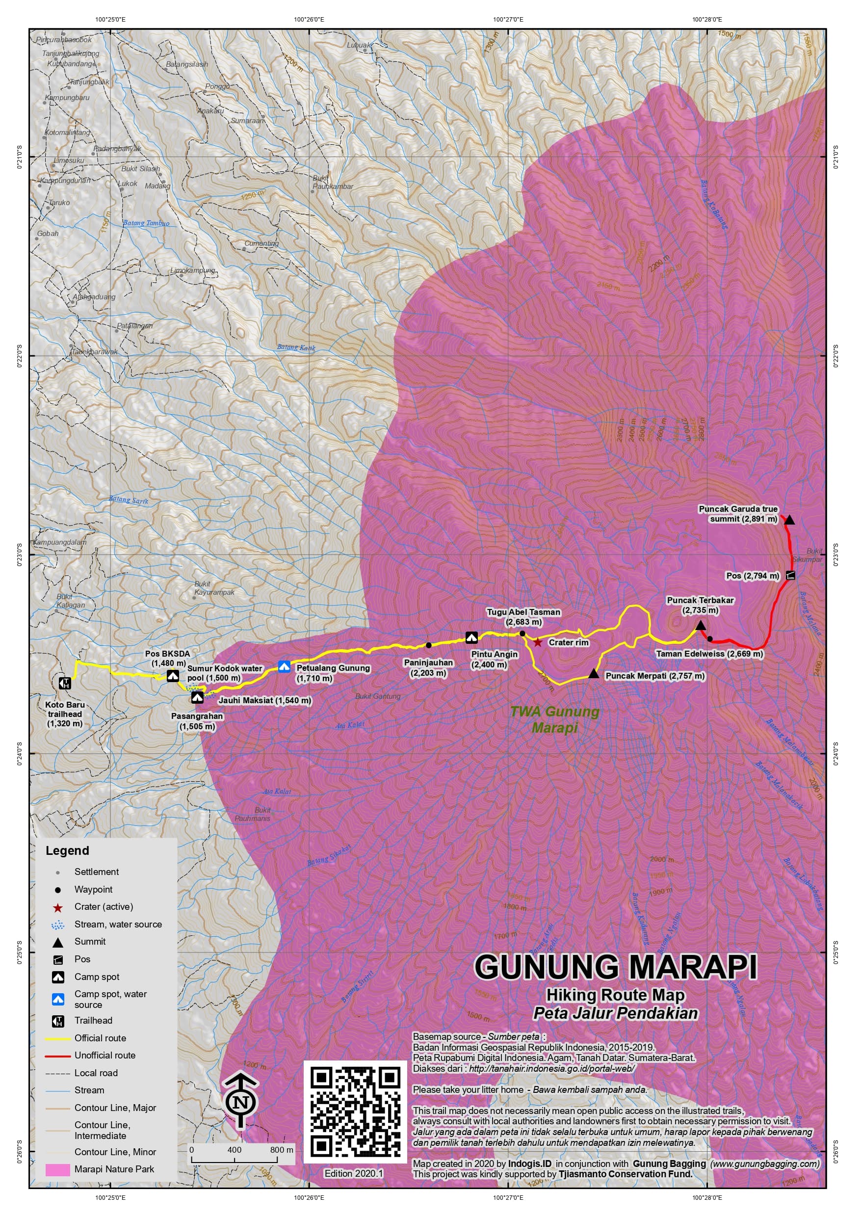
Jalur Pendakian Resmi
Memuat Peta Jalur Pendakian
Ketinggian (mdpl)
2,891 m
Prominence
2,116 m
Koordinat
-0.3804, 100.4736
Nama Lain
Summit name is Puncak Garuda.
Lokasi Peta (OSM)
Memuat Peta...
Informasi Pendakian
Guides and GPS Tracks: Want a PDF version for your phone? Looking for a guide? Need GPS tracks and waypoints? Gunung Marapi information pack can be downloaded here.
Trip planning assistance: Would you like Gunung Bagging to personally help you in arranging your whole trip? Please contact us here.
Permits: Register at the warung near the starting point above Koto Baru – take a photocopy of your passport photo page just incase they ask for it. You will have to pay about Rp20,000 per person (2017).
Water sources: On the usual route to the crater area there are plenty of water sources on the lower slopes (look out for the signs – ‘Air’). On the obscure route from Kacawali, water is apparently available at 1,400m and 2,500m.
Pembaruan Terakhir: 28 April 2026