

Gunung Dempo
Provinsi : Sumatera Selatan - Sumatra Island
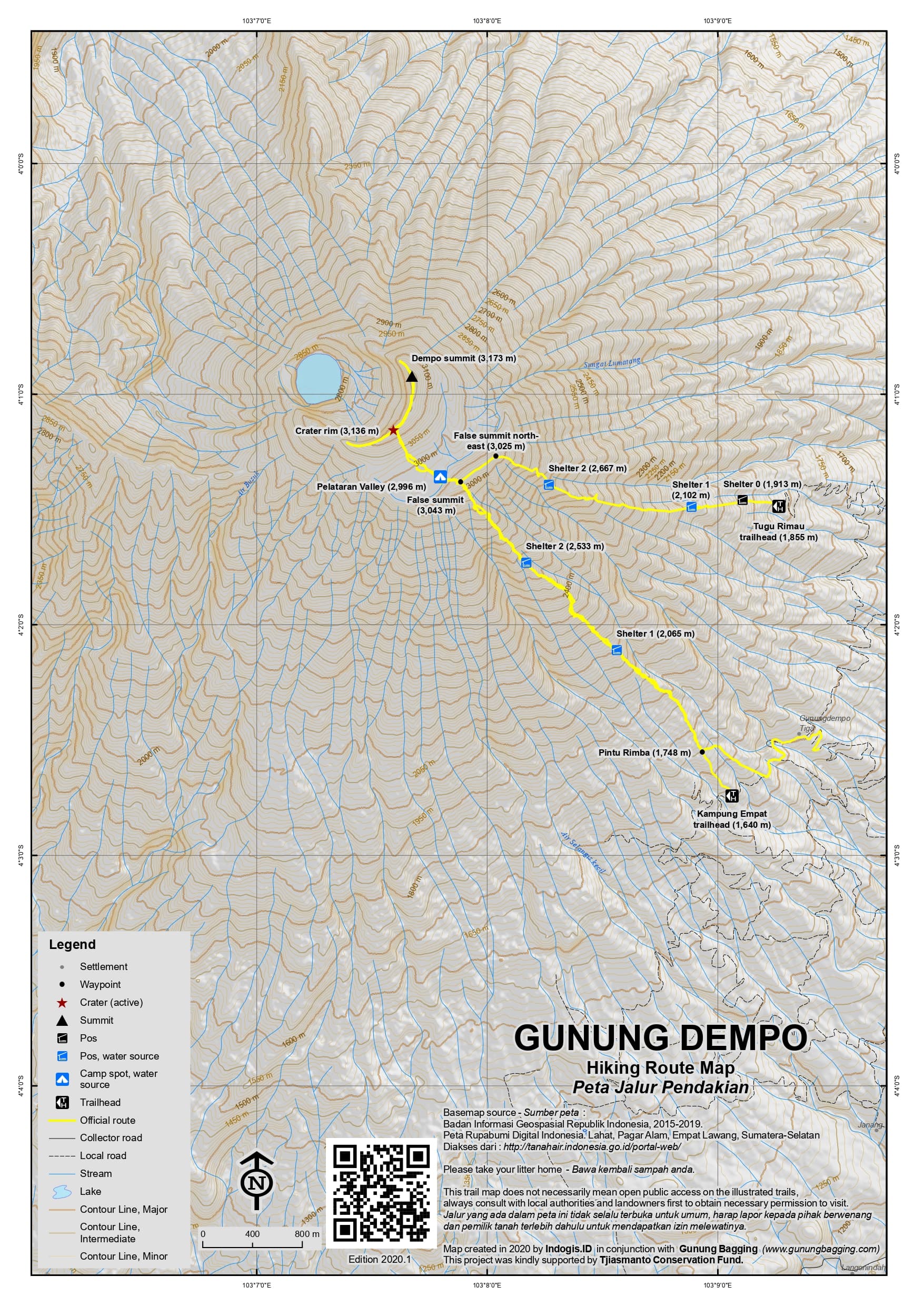
Jalur Pendakian Resmi
Memuat Peta Jalur Pendakian
Ketinggian (mdpl)
3,173 m
Prominence
2,450 m
Koordinat
-4.0155, 103.1280
Lokasi Peta (OSM)
Memuat Peta...
Informasi Pendakian
Guides and GPS Tracks: Want a PDF version for your phone? Looking for a guide? Need GPS tracks and waypoints? Gunung Dempo information pack can be downloaded here.
Trip planning assistance: Would you like Gunung Bagging to personally help you in arranging your whole trip? Please contact us here.
Permits: It is reported that trekkers are required to register before climbing at the tea company headquarters, but in practice, if you are climbing with a local companion, this can be overlooked. At weekends, you will probably have to pay Rp1,000 per person for entering the plantation and then Rp5,000 at the trailhead.
Water sources: There are several water sources on or near the main Kampung Empat trail. For both Kampung Empat and Tugu Rimau trails there is a good source at the Plataran valley camping area at 3,000m.
Pembaruan Terakhir: 09 April 2026