

Gunung Baluran
Provinsi : Jawa Timur - Java Island
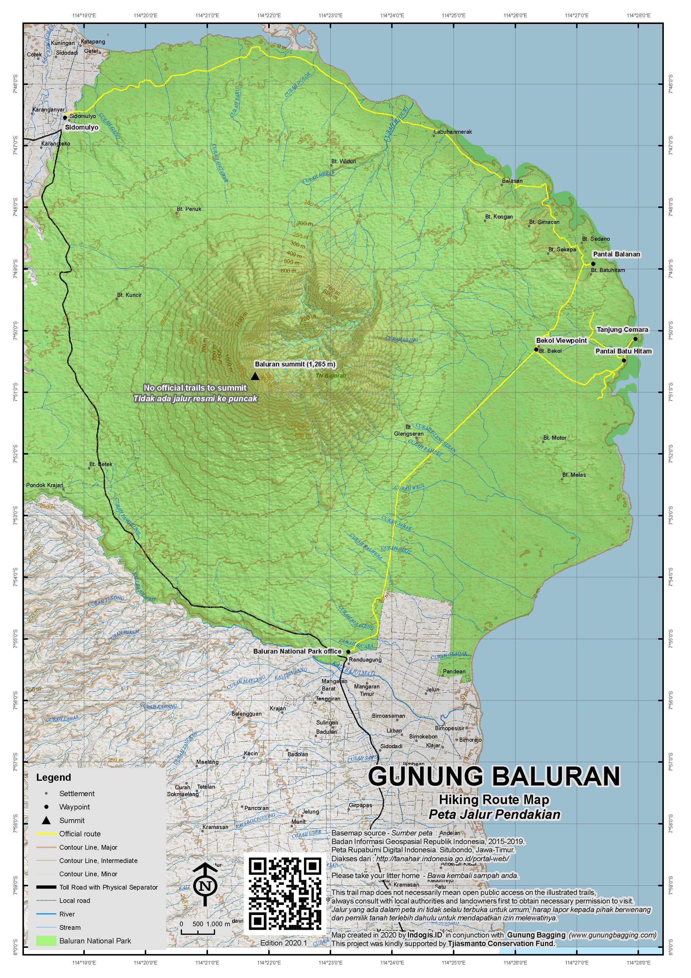
Jalur Pendakian Resmi
Memuat Peta Jalur Pendakian
Ketinggian (mdpl)
1,265 m
Prominence
1,022 m
Koordinat
-7.8456, 114.3629
Lokasi Peta (OSM)
Memuat Peta...
Informasi Pendakian
Guides and GPS Tracks: Want a PDF version for your phone? Looking for a guide? Need GPS tracks and waypoints? Gunung Baluran information pack can be downloaded here.
Trip planning assistance: Would you like Gunung Bagging to personally help you in arranging your whole trip? Please contact us here.
Permits: From the Baluran National Park office at Batangan at the entrance to the Park.
Water sources: Assume no water on the mountain; take sufficient supplies with you.
Accommodation: Try the Booking.com map above or use this link to search for suitable hotels, homestays, resorts and apartments for your trip.
We recommend Safety Wing as travel insurance for overseas travellers and tourists hiking up to elevations not exceeding 4500 metres.
Pembaruan Terakhir: 02 Desember 2026