

Gunung Anjasmoro
Provinsi : Jawa Timur - Java Island
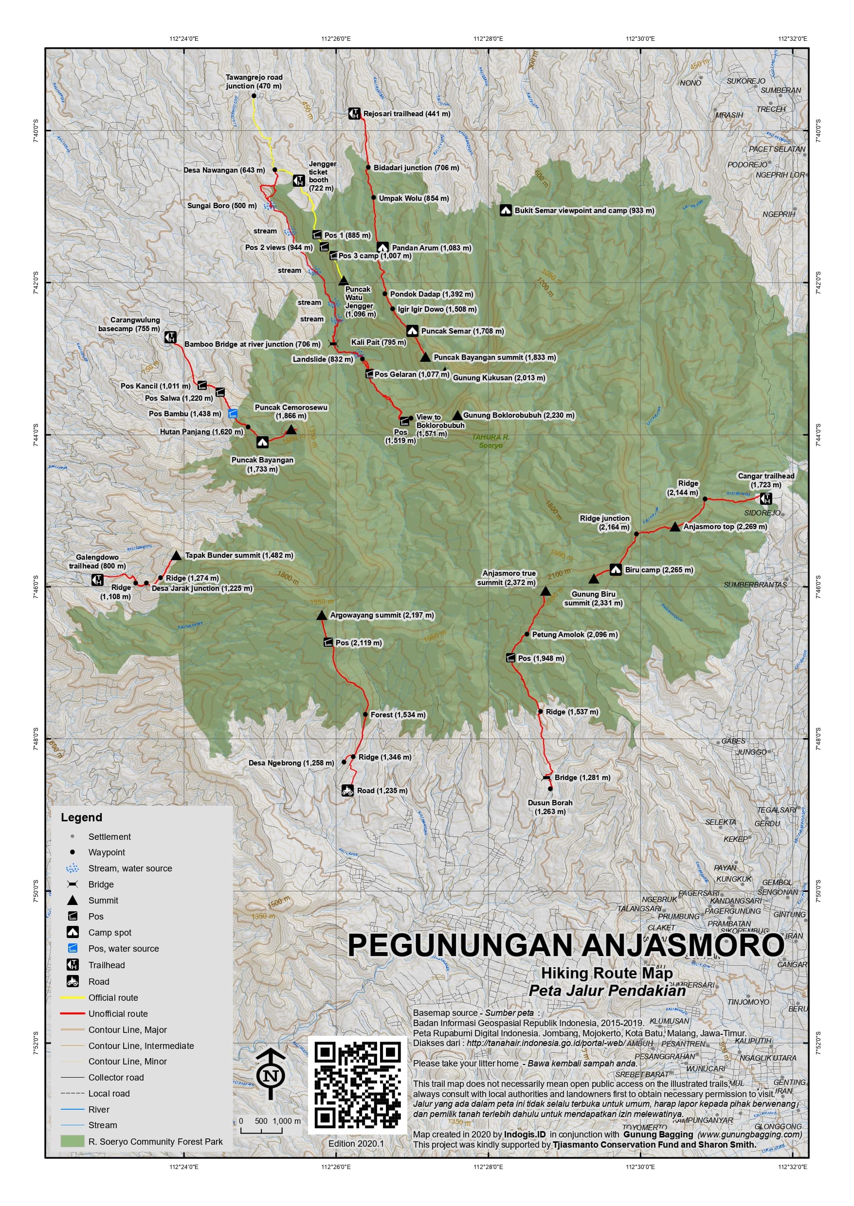
Jalur Pendakian Resmi
Memuat Peta Jalur Pendakian
Ketinggian (mdpl)
2,372 m
Prominence
641 m
Koordinat
-7.7676, 112.4790
Nama Lain
None, but there are numerous names for different peaks on the range. Anjasmoro is the name of both the range itself and also one of the tops.
Lokasi Peta (OSM)
Memuat Peta...
Informasi Pendakian
Guides and GPS Tracks: Want a PDF version for your phone? Looking for a guide? Need GPS tracks and waypoints? Gunung Anjasmoro information pack can be downloaded here.
Trip planning assistance: Would you like Gunung Bagging to personally help you in arranging your whole trip? Please contact us here.
Permits: For the Carangwulung, Wonosalam route simply register at the building next to the mosque in the village of Segunung. For the Cangar route, register at the office on the right side of the road at around 1,650m elevation between Sumber Brantas and Cangar. Approximately Rp15,000 each (or Rp50,000 per foreigner) in 2018. Take a photocopy of your passport photo page just incase.
Water sources: Near Pos 3 on the Carangwulung, Wonosalam route. None on the Cangar or Rejosari routes – take plenty of bottled water with you.
Accommodation: Try the Booking.com map above or use this link to search for suitable hotels, homestays, resorts and apartments for your trip.
We recommend Safety Wing as travel insurance for overseas travellers and tourists hiking up to elevations not exceeding 4500 metres.
Pembaruan Terakhir: 14 Juni 2026