

Gunung Bukit Daun – Gunung Hulu Palik
Provinsi : Bengkulu - Sumatra Island
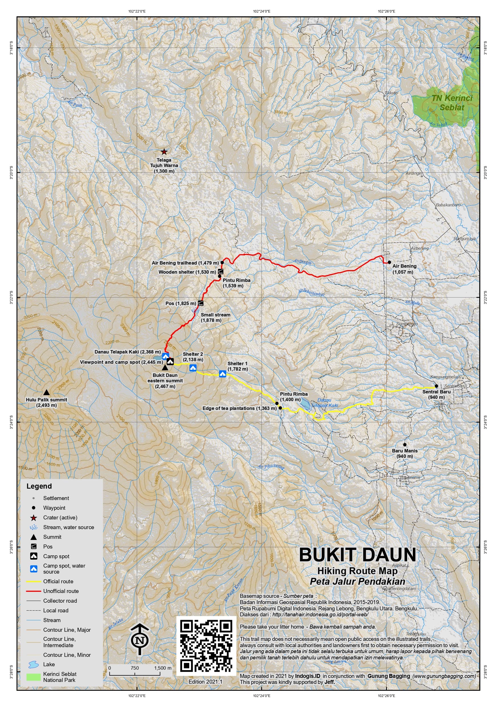
Jalur Pendakian Resmi
Memuat Peta Jalur Pendakian
Ketinggian (mdpl)
2,493 m
Prominence
1,541 m
Koordinat
-3.3920, 102.3425
Nama Lain
The highest peak is labelled Gunung Hulupalik on the Bakosurtanal map.
Lokasi Peta (OSM)
Memuat Peta...
Informasi Pendakian
Guides and GPS Tracks: Want a PDF version for your phone? Looking for a guide? Need GPS tracks and waypoints? Bukit Daun information pack can be downloaded here.
Permits: Register with the village head in Sentral Baru or Baru Manis. In 2021, Rp25,000 per group.
Water sources: Available at Shelter 1 (1,782m), Shelter 2 (2,138m) and at the lake (2,368m) but best boiled before use.
We recommend Safety Wing as travel insurance for overseas travellers and tourists hiking up to elevations not exceeding 4500 metres.
Pembaruan Terakhir: 03 Juni 2026